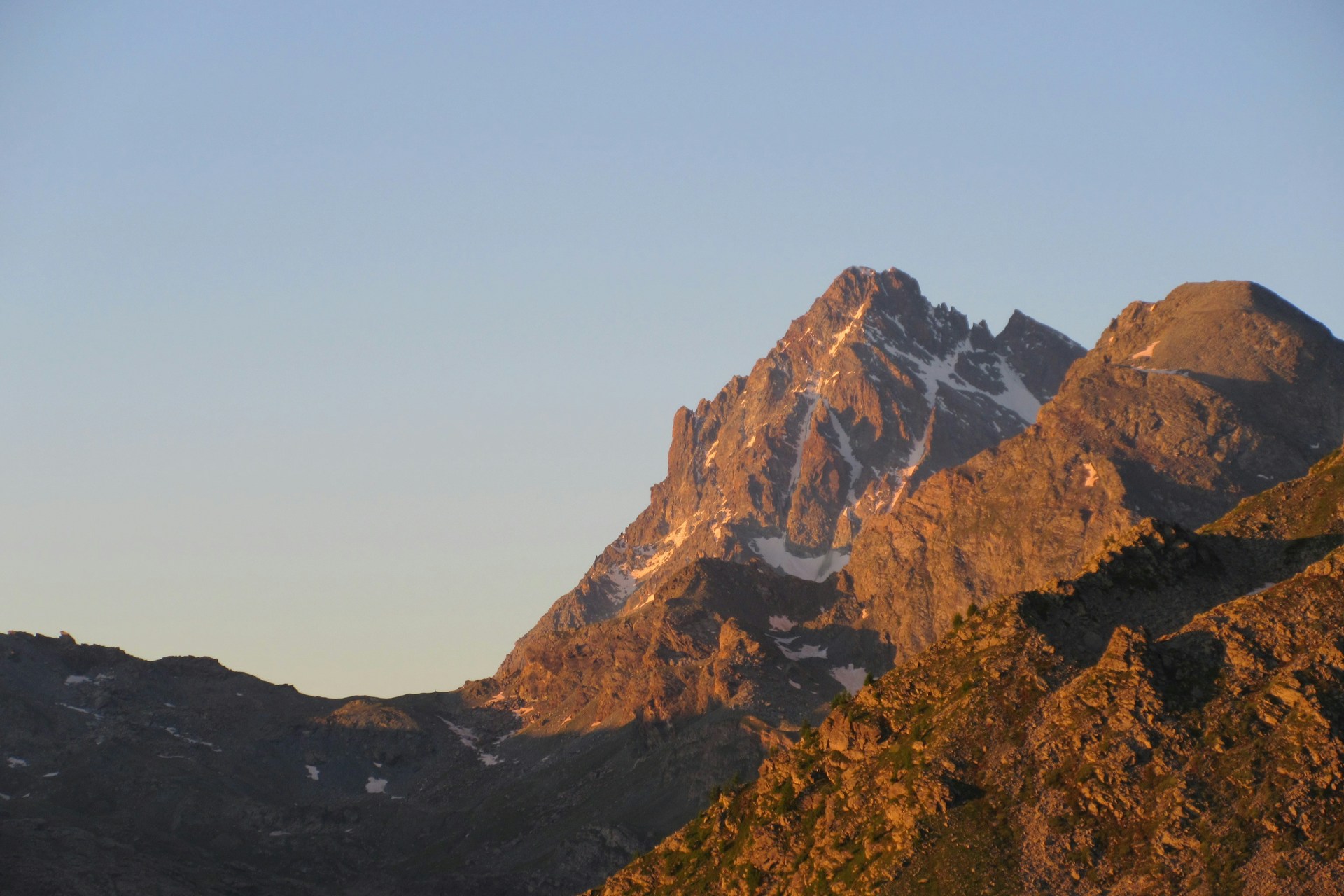
Gran Tour del Monviso
A stunning multi-day circular hike around the Monviso massif — often called the “King of Stone” — this is one of the best hut-to-hut hikes in the Italian Alps. Known as the Gran Tour del Monviso, the route covers about 55 kilometers over four days, offering wide views of the surrounding peaks and a deep mountain feel throughout. The trail begins in the Piedmont region, at Rifugio Barbara Lowrie, and leads through alpine meadows to Rifugio Willy Jervis on day one. The second day is the toughest, with around 16 kilometers and more than 1500 meters of climbing as you cross remote high passes to reach Rifugio Vallanta. On day three, the path winds across quiet valleys and rocky terrain to Rifugio Quintino Sella al Monviso, perched high above the tree line. The final stage returns you to the start, with a mix of steady climbs, long descents, and sweeping alpine views. This high-altitude trekking route offers changing scenery every day — green meadows, rocky trails, glacier views, and quiet ridgelines — making it one of the best multi-day hikes in Italy for those who want to explore the Alps beyond the busy tourist areas.
Hike Details
- Difficulty
- Difficult
- Type
- Circular
- Duration
- 4 days
- Total Distance
- 56.4 km (35.0 mi)
- Elevation Gain
- 4558 m (14954 ft)
Location
- Continent
- Europe
- Country
- Italy
- Region
- Cottian Alps
- Best Season
- July, August, September
Photo Gallery
Highlights
- Panoramic views of Monviso from multiple angles
- Beautiful alpine lakes and meadows
- Historic mountain refuges
- Rich alpine flora and fauna
Requirements
- Good physical condition
- Hiking boots
- Waterproof clothing
- Basic mountaineering equipment
- Sleeping bag liner
Route Map
Day by Day
Day 1: Rifugio Barbara Lowrie to Rifugio Willy Jervis
The Gran Tour del Monviso begins at Rifugio Barbara Lowrie, located in the heart of the Piedmont Alps. This first day is a gentle introduction to the circuit, following well-marked trails through alpine meadows, larch forests, and quiet valleys. The route is scenic and not too demanding, making it a great warm-up day. Along the way, hikers enjoy wide views of the surrounding mountains and the sound of alpine streams. The day ends at Rifugio Willy Jervis, a cozy mountain hut known for its good food and peaceful setting in the Vallone di Pellice.
Day 2: Rifugio Willy Jervis to Rifugio Vallanta
This is the toughest and longest day of the Gran Tour del Monviso, with a full day of hiking through high mountain terrain. The trail climbs steadily through rocky paths and crosses several high-altitude passes, including the Colle di Viso. Expect steep ascents, long traverses, and panoramic views of the Monviso massif. The route passes through remote landscapes and offers a true alpine experience far from the crowds. Rifugio Vallanta, your destination for the night, is located in a dramatic glacial cirque and is a favorite for experienced hikers tackling the western side of Monviso.
Day 3: Rifugio Vallanta to Rifugio Quintino Sella al Monviso
Day three continues the high-altitude loop around Monviso with a route that crosses into the upper Vallone di Vallanta. The trail includes rocky ridgelines, scree slopes, and occasional snow patches depending on the season. It’s a quieter, more rugged section of the tour that shows the wilder side of the Italian Alps. The hike finishes at Rifugio Quintino Sella al Monviso, one of the most iconic huts in the Alps, perched at 2,640 meters with breathtaking views of the Viso glacier and the surrounding peaks. This stage is ideal for those who enjoy alpine scenery and remote mountain paths.
Day 4: Rifugio Quintino Sella al Monviso to Rifugio Barbara Lowrie
The final stage of the Gran Tour del Monviso begins with a steady descent from Rifugio Quintino Sella, passing through rocky trails and meadows as you gradually lose elevation. The route offers sweeping views across the Po Valley and continues along forested paths, open slopes, and well-trodden mule tracks. As you complete the circular route and return to Rifugio Barbara Lowrie, you'll pass some of the same landscapes seen on Day 1 but from a fresh perspective. This last day ties together the variety of terrain the Monviso loop is known for — from alpine ridges to wooded paths — making it one of the most complete multi-day hikes in the Western Alps.
Sleeping Options
How to Get There
Download GPX Track
Download the GPX track for this hike to use with your GPS device or hiking app.