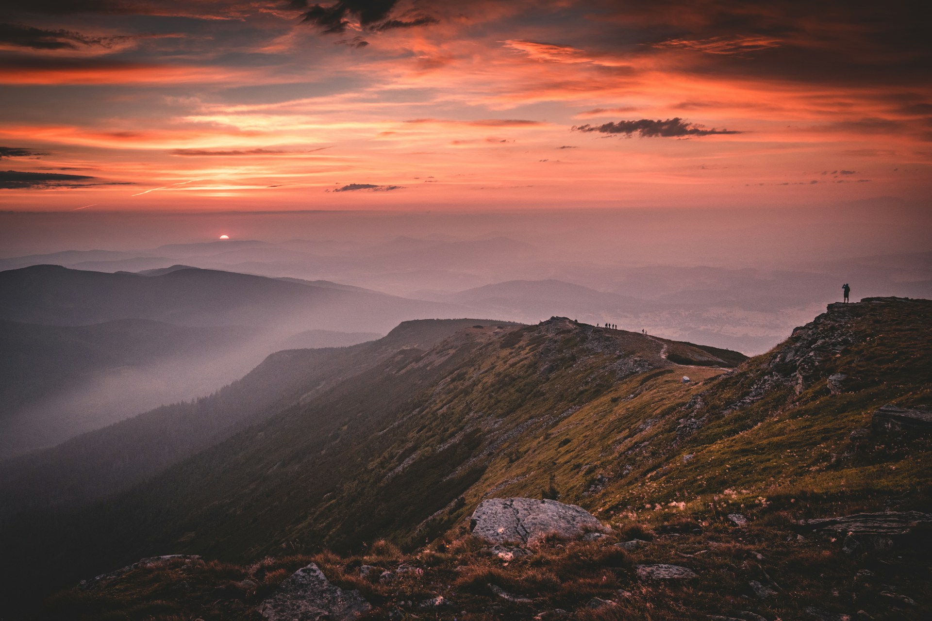
Babia Góra
A peaceful and rewarding 3-day hike in southern Poland, crossing the iconic Babia Góra range in the Beskid Żywiecki mountains. This classic hut-to-hut route starts in Jordanów and ends in Zawoja, taking you through the protected forests of Babia Góra National Park, over scenic ridgelines, and to the summit of Babia Góra — the highest peak in the Beskids. The trail includes overnight stays in traditional PTTK mountain huts and offers quiet forest paths, open meadows, and wide panoramic views, including a clear view of the Tatra Mountains from several points along the route. Day 1 begins in Jordanów and follows quiet village roads and forest tracks through Bystra Podhalańska before transitioning into a steady climb through the Beskid forest. The day ends at Schronisko PTTK na Hali Krupowej, located in an open clearing with views of the Tatras on clear days. Day 2 leads from Hala Krupowa through the Polica peak and across Przełęcz Krowiarki (Krowiarki Pass), climbing to Kępa and then the summit of Babia Góra at 1,725 meters. This is the highest point of the route and offers sweeping views in all directions. The descent follows a rocky, exposed path down to Przełęcz Brona (Brona Pass) and then to Schronisko PTTK na Markowych Szczawinach, a cozy hut nestled in the forest. Day 3 is an easier descent through forest roads and well-maintained trails, leading to Zawoja, a long village known for its wooden architecture, peaceful atmosphere, and role as a base for exploring Babia Góra National Park. This hike is best done in dry weather. The summit section can be slippery and exposed during fog or storms, and proper hiking boots and layers are essential. For hikers looking for a scenic and uncrowded 3-day hike in Poland with great views and traditional mountain huts, this route is a top choice.
Hike Details
- Difficulty
- Easy
- Type
- Point to Point
- Duration
- 3 days
- Total Distance
- 46.1 km (28.6 mi)
- Elevation Gain
- 2023 m (6637 ft)
Location
- Continent
- Europe
- Country
- Poland
- Region
- Beskid Mountains
- Best Season
- May, June, July, August, September
Photo Gallery
Highlights
- Summit of Babia Góra (1725 m) with views of the Tatra Mountains
- Two overnight stays in traditional PTTK mountain huts
- Peaceful trails through spruce forests and alpine meadows
Requirements
- Good fitness for long ascents and descents
- Sure-footedness on rocky and uneven trails
- Comfort with exposed mountain sections
- Weather-appropriate clothing and gear
- Enough water and food for summit day
Route Map
Day by Day
Day 1: Hike from Jordanów to Schronisko PTTK na Hali Krupowej
Start your 3-day Babia Góra hike in the town of Jordanów, following quiet country roads past the Skawa River and through small villages. After Bystra Podhalańska, the trail enters forested terrain and open alpine meadows. This scenic route climbs steadily into the Beskid Żywiecki range, ending at Schronisko PTTK na Hali Krupowej — a traditional Polish mountain hut known for its peaceful setting and panoramic views of the Tatra Mountains.
Day 2: Crossing Babia Góra to Schronisko PTTK na Markowych Szczawinach
This is the most challenging and rewarding stage of the hike. The trail climbs through dense forest to Polica peak, then continues across Przełęcz Krowiarki (Krowiarki Pass) and up the ridge toward Kępa. From there, a final push takes you to the summit of Babia Góra — the highest mountain in the Beskid Mountains and a key highlight of the Babia Góra National Park. The summit offers stunning panoramic views across the Tatras and western Carpathians. A steep and rocky descent via Przełęcz Brona (Brona Pass) brings you to Schronisko PTTK na Markowych Szczawinach for an overnight stay.
Day 3: Descent from Markowe Szczawiny to Zawoja
The final day of the Babia Góra trek is an easier descent through wooded trails down to Zawoja — one of the longest villages in Poland and a popular gateway to Babia Góra National Park. This scenic end to the hike brings you out of the forest and into a charming village known for its traditional wooden houses, local cuisine, and excellent views of the Babia Góra massif.
Sleeping Options
How to Get There
Download GPX Track
Download the GPX track for this hike to use with your GPS device or hiking app.