Apuseni
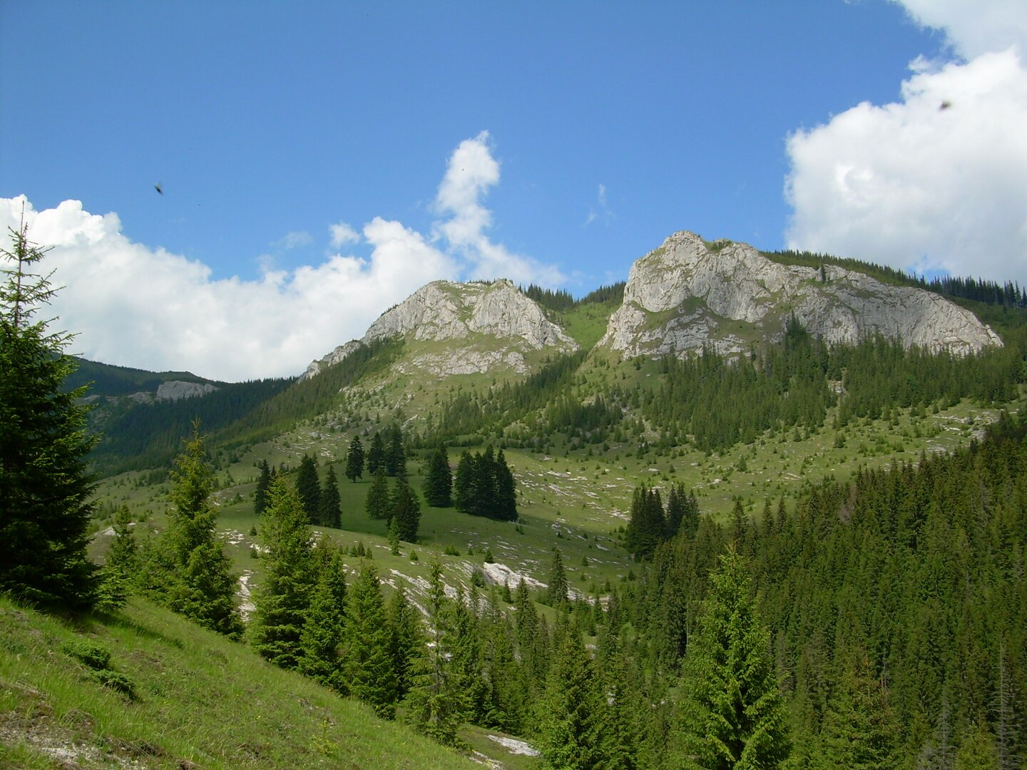
This scenic hike through the Apuseni Mountains offers a mix of waterfalls, panoramic ridges, and forest trails. The route begins in the village of Răchițele, climbing steadily past the dramatic Vălul Miresei Waterfall (also known as “Bride’s Veil”), one of the most iconic natural sights in the region. From there, the trail continues up to the Pietrele Albe ridge, offering sweeping views across the Vlădeasa range and deep forested valleys below. After a rocky descent and short forest transition, the route climbs again to reach the summit of Vlădeasa Peak (1836 m) — the highest point on this trail and one of the tallest in the Apuseni. The day ends at Cabana Vlădeasa, a basic mountain hut located just below the summit. It’s a perfect overnight stop for hikers looking to split the route into two relaxed days. On the second day, the trail descends gradually through open meadows and pine forest, eventually reaching the village of Săcuieu, where the hike ends. Fit and experienced hikers can complete the full route in a single long day with an early start, but splitting it into two days gives you more time to enjoy the scenery and stay overnight in the mountains.
Hike Details
- Difficulty
- Moderate
- Type
- Point to Point
- Duration
- 2 days
- Total Distance
- 29.5 km (18.3 mi)
- Elevation Gain
- 1249 m (4098 ft)
Location
- Continent
- Europe
- Country
- Romania
- Region
- Carpathians
- Best Season
- June, July, August, September, October
Photo Gallery
Highlights
- Vălul Miresei Waterfall (Cascada Vălul Miresei)
- Pietrele Albe ridge views
- Vlădeasa Peak (1836 m)
- Cabana Vlădeasa overnight stay
- Panoramic views of Apuseni Mountains
- Wildflower meadows in summer
- Quiet forest trails
- Open alpine ridgelines
- Dramatic rock formations
Requirements
- Moderate to high fitness level
- Comfortable with long ascents and descents
- Proper hiking boots
- Weather-appropriate clothing
- Map or GPS navigation
- Water and food for the day
- Headlamp if starting early or splitting into 2 days
- Trekking poles recommended
- Optional overnight gear for Cabana Vlădeasa
- Awareness of changing mountain weather.
Route Map
Day by Day
Day 1: Răchițele to Cabana Vlădeasa via Vălul Miresei and Pietrele Albe
Start in Răchițele village and hike past the famous Vălul Miresei Waterfall (Cascada Vălul Miresei). Climb steadily through forest and exposed ridgelines to reach Pietrele Albe for sweeping views. Continue with a final push to Vlădeasa Peak (1836 m), then descend to Cabana Vlădeasa for an overnight stay.
Day 2: Cabana Vlădeasa to Săcuieu
Descend from Cabana Vlădeasa through gentle forest trails and open meadows. The trail is easier and mostly downhill, leading to the quiet village of Săcuieu. A great way to end the route with relaxed walking and scenic views.
Sleeping Options
Cabana Vlădeasa
Cabana Vlădeasa is a rustic mountain hut situated at 1,430 meters altitude on the northern slope of the Vlădeasa Massif. It offers a total of 30 beds distributed across various room types, including a 13-bed room, an 8-bed room, and three 3-bed rooms. Each room is equipped with heating stoves, electricity, and shared sanitary facilities. The hut provides meal services for guests and serves as a base for ascents to Vlădeasa Peak (1,836 m). Access is typically via forest roads from Bologa or Săcuieu, followed by a hike from Rogojel village.
Visit WebsiteHow to Get There
Download GPX Track
Download the GPX track for this hike to use with your GPS device or hiking app.